본문 바로가기
주메뉴 바로가기
주메뉴
Company
Introduction
Greeting
History
Vision/CI
Organizational Chart
Licenses
Directions
Greeting
History
Vision/CI
Organizational Chart
Licenses
Directions
Business Sector
Oceanographic Survey/Exploration
Marine Physical
Maritime Ecology/Environment
Geodetic Survey
Stream and Beach Survey
Oceanographic Survey/Exploration
Marine Physical
Maritime Ecology/Environment
Geodetic Survey
Stream and Beach Survey
Business Results
Technologies
and Equipment
Equipment Introduction
Patents
Equipment Introduction
Patents
Customer Support
Notice
Recruitment
Inquiry
Notice
Recruitment
Inquiry
KOREAN
ENGLISH
전체메뉴
모바일메뉴열기
주메뉴
Company Introduction
Greeting
History
Vision/CI
Organizational Chart
Licenses
Directions
Business Sector
Oceanographic Survey/Exploration
Marine Physical
Maritime Ecology/Environment
Geodetic Survey
Stream and Beach Survey
Business Results
Technologies and Equipment
Equipment Introduction
Patents
Customer Support
Notice
Recruitment
Inquiry
KOREAN
ENGLISH
메뉴 레이어 닫기
Technologies and Equipment
A company specialized in marine exploration and surveying with the best technology and advanced marine equipment.
Equipment Introduction
Patents
Patents
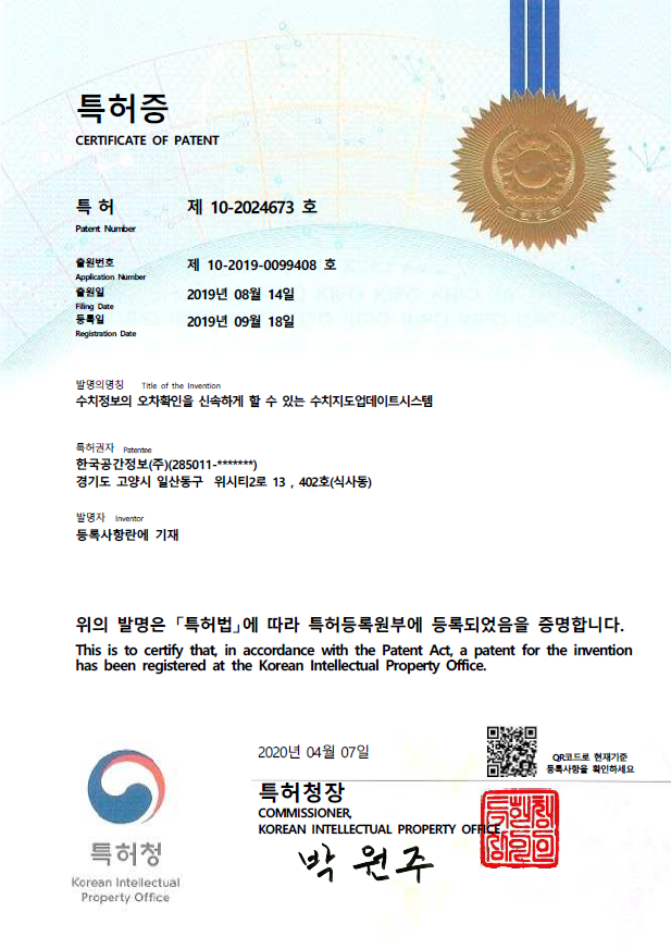
A numerical map update system that can quickly check the error of numerical information
Admin
2021-03-12
Views
605
List
Prev
Small boat single beam mounting frame structure for shallow water depth survey
Next
A precision map construction system that can produce map data using MMS with imp...