Business Sector
A company specialized in marine exploration and surveying with the best technology and advanced marine equipment.
Oceanographic Survey/Exploration
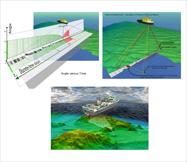
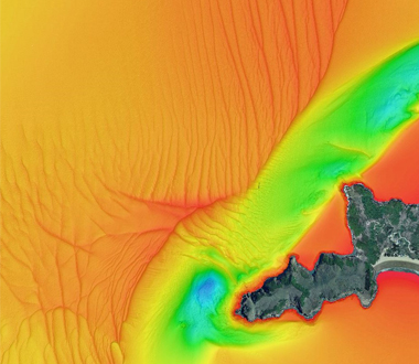
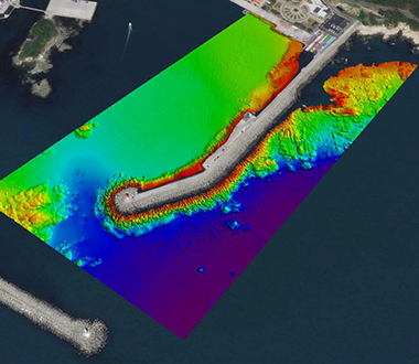
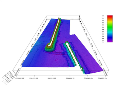
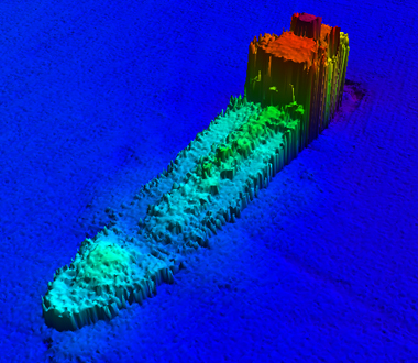
Submarine Topographic Survey
- We provide various oceanographic information by checking water depths and precise submarine topography through multibeam echosounders.
- It is used for various fields, including surveys for goods dangerous to sailing, the installation status survey for seabed structures, surveys of ideal places for artificial fishing banks and facility status, dam sediment surveys, harbor design and construction.
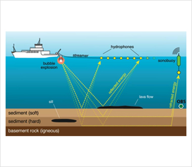
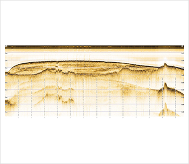
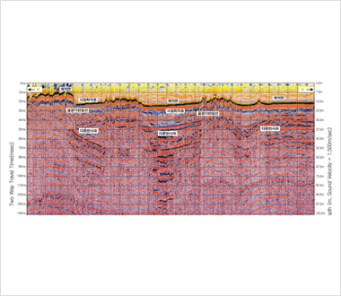
Undersea Layer Exploration
- We determine the characteristics of the sedimentary layer and stratum by recording reflected or refracted low/high frequencies that return from undersea layers with a receiver.
- It is used for several investigations such as to find buried bodies, resources, geological features and stratum structures.
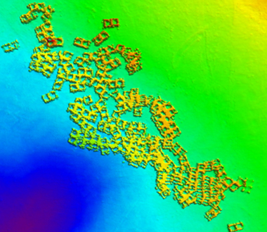
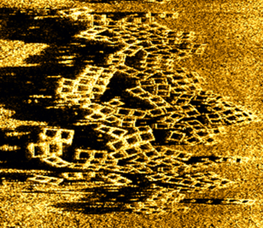
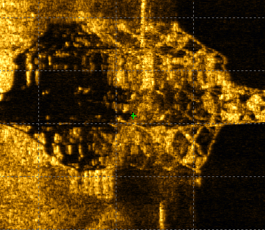
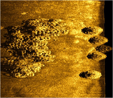
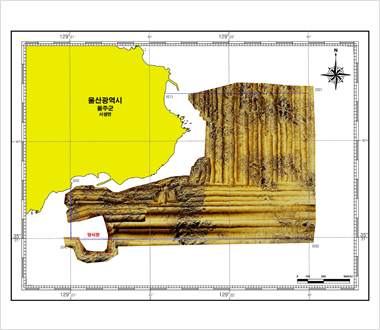
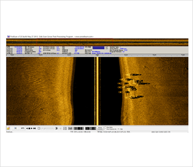
Sea-bed Image Exploration
- We provide wide area scanned images of the sea-bed by using a side scan sound wave instrument which receives and records the scattered waves generated from an object.
- It is used for the exploration of undersea objects and to investigate sea-bed status and submarine resources.

Waterway Measurement
- For the purpose of creating marine charts for safe sailing, we provide measurements of water depths, geological features, topography, the terrestrial magnetism of sea, stream and lake as well as the measurement of the location of islands and rocks, tide currents and sea currents.
- Harbor surveys, passage surveys, coastal surveys and oceanographic surveys, etc.
하단영역
402, 13, Wi city 2-ro, Ilsandong-gu, Goyang-si, Gyeonggi-do, Republic of Korea TEL : 031-994-8662 FAX : 031-994-8663
Copyright © 2021 한국공간정보(주). ALL RIGHTS RESERVED.
Copyright © 2021 한국공간정보(주). ALL RIGHTS RESERVED.
